Italy: Trentino-Alto Adige/Südtirol
Until this area was annexed by Italy in 1919, this region was part of Austria-Hungarian empire and before by the Austrian Empire and the Holy Roman Empire. Together with the Austrian state of Tyrol it is represented by the Euroregion Tyrol-South Tyrol-Trentino. The region is a biking meca and one of the premier riding destinations in Europe. Currently the region is among the wealthiest and most developed in both Italy and the European Union.
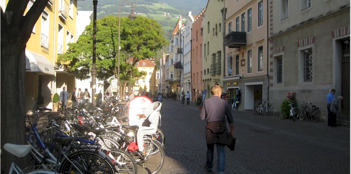
 Bressanone.
Most of the riding is on traffic free cycleways along river valleys to mountain passes into Austria where one can continue to Innsbruck to the north or to the Drau and Mur bikeways to the east and into Slovenia.
The Trentino-Alto Adige/Südtirol cycle paths are divided into several parts:
 In the north, the South Tyrolean Cycle Trail connects the seven cities of South Tyrol, "in an excursion of nature and culture." There are two variants to the trail. Variant A starts from the city of Vipiteno near the Austrian border, passing through the Val Pusteria, up to Brunico. From here the route take you back to the Valle Isarco, until you reach Bressanone and the down to regional capital, Bolzano. From Bolzano ride to Lake Caldaro, to reach the town of Merano across the Val Venosta, up to the walled town of Glorenza. Distance: 272 kilometers. Elevation change: 2000 meters.
Variant B Starts in Glorenza (Glurns), the smallest town in South Tyrol, across the Val Venosta to Merano. Then from Bolzano cross the Val d'Isarco, passing through the artistic town of Chiusa, up to the city of Bressanone and Brunico. Concluding with the final stage at Vipiteno. Distance: 270 kilometers. Elevation change: 2000 meters.
Continuing past Vipiteno to Brenner the cyclist can continue into Austria and then Innsbruck. The route connects with the Inn Radweg, one of Austria's premier cycleways. The Inn river, a tributary of the Donau (Danube) joins the Danube cycleway at Passau. The Inn Radweg travels downstream from Innsbruck to Imst and then connects with the Via Claudia cycleway. Innsbruck is an excellent city for a visit with many activities, a folk museum, ride to the ski area and other sights.
South from Bozen (Bolzano)
From Bozen (Bolzano) the route joins with the Via Claudia Augusta/EtschRadweg (Ciclabile dell'Adige) following the Adige (Etsch) river southwards through vineyards and many miles of apple trees in Italy's largest apple-growing area. From the largely German-speaking Sud Tyrol (or Alto Adige in its official Italian name) the route crosses into the mainly Italian speaking provincia di Trento (Trentino) and the route's name changes to the Ciclabile della Valle dell'Adige Sud.
Traveling east from Bressanone (Brixen) and Brunico (Brunek) the route continues from Toblach (Dobbiaco) to Innichen (San Candido) and from there to the source of the Drau (Drava). This is a connection to the excellent ride into Austria along the Drau and Mur rivers and into Slovenia as described on other pages on this site.
Guides, Maps and Other Information

South Tyrolean Cycle Trail Offers the best opportunity for cycling enthusiasts to discover the many beauties of Alto Adige

Bike Paths in South Tyrol Ideal for discovery journeys across the most important valleys and villages of South Tyrol

Via Claudia Augusta Covers all aspects of the VCA.

Kompass Alto Adige Has detailed maps of the route and elevation profiles. In Italian, available on www.amazon.it.
 Bikeline Has several guides that cover this section of Italy.
Italy Cycling Guide "An independent resource for cycle touring in Italy." The best guide to cycling in Italy.
 An Italian national bicycle network that covers routes with far-reaching links for cycling, a cross-regional dimension or connecting with neighboring countries.
The Touring Club of Italy has other helpful guides. Touring Club of Italy can be found at this link.
See the Maps and Guides page for more mapping information.
Map information
There are many cycling apps with maps available for iphone and android. A couple of the better offline apps are listed here.
 Can be used to follow this route (and other routes) Click here for a KML file that can be loaded into the app. Place the file in the maps.me bookmarks folder (MapsWithMe/bookmarks on your phone or tablet) or alternately, email/text it to your device and open the file with maps.me. Total Commander works great for managing and opening files.
 Guru Maps has the ability to show map types other than OpenStreetMap, in particular it will display OpenCycleMap. KML files can be imported by "opening" the file with Guru. Place the file in a folder or email/text it to your device, press and hold and open with the app. The route will appear in "collections." A user manual is available.
What it is Like
- Travel Tips
The train system can be used to travel to the top the passes on the border with Austria. From there its an easy ride down hill into Italy. Some cities such as Balzano have large, high quality trams systems that will take you up into the mountains. Take your bike with you and ride back down but make sure your brakes are in good order.
- Ride Quality
The cycleway quality varies depending on the region of the ride but overall the cycleways are developed bike paths or low-traffic country roads. Most of the cycleways in this area on traffic free paved cycleways. In lesser traveled valleys there are a few sections of unpaved forest and dirt roads however these are easy to navigate.

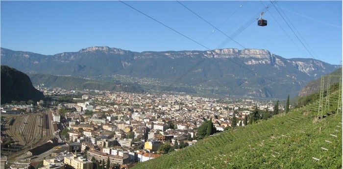
Tram line from Balzo to the mountain villages above town.
- Elevation Change
Since the cycleways follow river valleys there is a continuous gradient up or down depending on your direction but not too steep. In the mountains near the Austrian border the route can be fairly steep but not extreme.

Near Resia-Reschen close to the border with Austria. Most of the route is similar to this, rural and on a small path
- Best Season
Spring when the apple trees are in bloom is a great time to be there and late September when the fruit is ready is also great. In summer the temperatures in Bozen can be in the upper 30s but its cooler higher in the mountains.

This is the largest apple growing region in Italy.
- Options
Bolzano is a good place to start your travels. From here you can choose any of the options or directions on the cycle routes and use the train system to return if you don't want to cycle the same path twice.
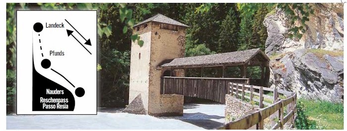
-Shuttles The Via Claudia Augusta cycleway has 6 shuttle bus services provided to support the route. Two of these are in the Austrian section and the remaining four in Italy. There is nothing to stop you from riding on if you're feeling strong, however the shuttles over the Fernpass and from Trento to the Lago di Caldonazzo are a good option. The descent from the Fernpass is a mountain bike track which could be difficult on a loaded touring bike. From Reschenpass you can catch a shuttle to Landeck and connect with the Inn river.

Signage and shuttle stop for Reschenpass