Switzerland Long Distance Routes
Switzerland is our recent ride (July 2021) on some of the long distance routes around the country, primarily the Rhone, Rhine and Mittelland routes. This itinerary took us around the entire country and included all of Lichtenstein and parts of Austria. We used to the train system to get over high mountain passes which would have been extremely difficult when carrying luggage in panniers. The Swiss have an excellent velo site and in particular SwissMobility Plus is well worth the small fee. There is both a mobile and a desktop version.
Our impression of Switzerland is that it has good parts and bad parts. Switzerland is definitely an industrialized country with lots of industry in the river valleys and near the larger cities. It seemed like everywhere there was construction, pouring concrete and road building. Many large trucks and freight vehicles travel the highways bringing in supplies from other parts of Europe.
Many rural parts of Switzerland still exist though and of the course the Alps are still there covered in hotels and ski areas. You can bike ride through beautiful agricultural lands on car free paved pathways and talk to the many cows along the way. Almost everyone speaks some English and its easy to get supplies along the way. No need to carry much extra clothing or food. Everyone seems to travel at times on the many bikeways.
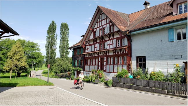
Riding past a historical Swiss home with a barn attached.
Guides, Maps and Other Information
SuisseMobile Plus Official site for routes in Switzerland. A great tool I wish could be used in all of Europe. Click on the "Draw a Course" to go to the maps. Design and archive your own routes, Calculate their characteristics (length, height difference, longitudinal profile, travel time), Print routes Add texts and photos to the routes, and download GPS tracks.
![]() SwitzerlandMobility A detailed description of all the cycling routes can be found here and there are many. Use this tool to explore the potential routes you would like to use. Beware that some routes can be very difficult.
SwitzerlandMobility A detailed description of all the cycling routes can be found here and there are many. Use this tool to explore the potential routes you would like to use. Beware that some routes can be very difficult.
See the Maps and Guides page for more mapping information.
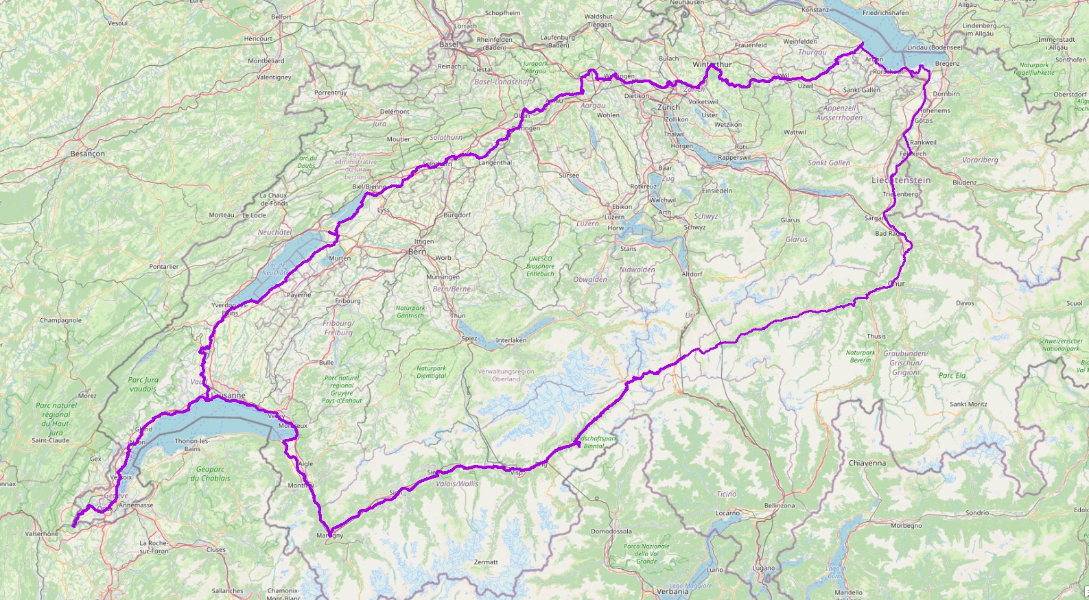
Switzerland, click for larger image. The purple lines are the routes we used. Here are the GPS tracks that be imported to Maps.Me or other apps to help with your navigation. Rhone, Rhine, and Mittelland.
There are many cycling apps with maps available for phone/ android. Here are a couple of the better off line apps.
![]()
Can be used to follow this route (and other routes)
If you have a KML file of a route, place the file in the maps.me bookmarks folder (MapsWithMe/bookmarks on your phone or tablet) or alternately, email/text it to your device and open the file with maps.me. Total Commander works great for managing and opening files.
![]() Guru Maps can show map types other than OpenStreetMap, in particular it will display OpenCycleMap. KML files can be imported by "opening" the file with Guru. Place the file in a folder or email/text it to your device, press and hold and open with the app. The route will appear in "collections." A user manual is available.
Guru Maps can show map types other than OpenStreetMap, in particular it will display OpenCycleMap. KML files can be imported by "opening" the file with Guru. Place the file in a folder or email/text it to your device, press and hold and open with the app. The route will appear in "collections." A user manual is available.
What the ride is like
- Travel Tips
The Swiss train system is great and can be used to get up or over the famous mountain passes. We didn't encounter any problems taking our bikes on trains, just look for the car with the bike symbol. Trains are frequent, just wait for the next one at any station.
- Ride Quality
About 75 percent of the routes we used where paved and the gravel portions were easily navigated with road bikes using moderately wide tires. We use Continental Gator Hardshell 32 x 700c tires. All of the routes are extensively signed and easy to follow. Swiss routes are designed to connected transportation options and will go train and bus stations. You may want deviate from the route if you are not planning to use the train system.
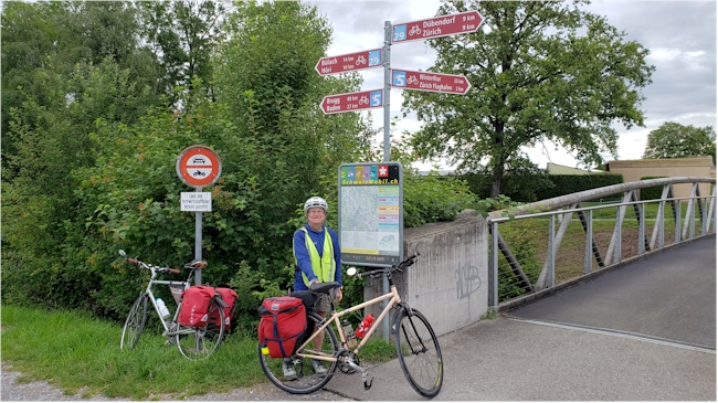
Routes are well signed and easy to follow.
The long distance routes travel through a wide range of scenery and industrial areas. We found Lichtenstein surprisingly industrialized while parts of Austria where very rural and old Europe. Most major river valleys have light industry and lots of car and truck traffic. Agriculture and livestock are found everywhere, even high into the Alps. It seems like every mountain has a cable car to the top with a ski area.
The three long distance routes we used, Rhine, Rhone and Mittelland pretty much circumnavigated the country including Lichtenstein and gave us a complete view of both the highlands and lowlands of Switzerland.
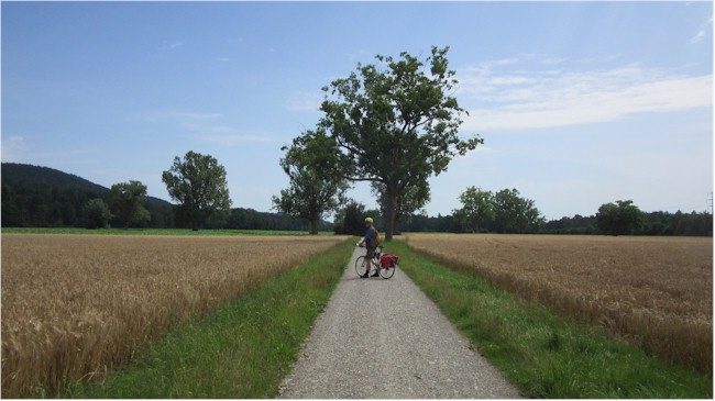
Portions of the long distance routes are gravel surface but in good shape.
- Elevation Change
Elevation changes are extreme along many portions of the long distance routes but trains can be used to get around the most difficult sections. Swiss routes are mostly located along the easiest option for cyclists. Elevation profiles can be found on the SwissMobility Internet site and in the app.
- Best Season
Spring and fall. Summers in Europe are increasingly hot and only a small number of Swiss hotels have air conditioning. June through August are the wettest months in Switzerland so be prepared for rain in the summer. Some of our routes were flooded although it was unusually rainy.
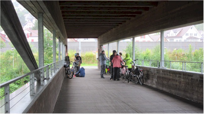
Riders under a covered bridge taking shelter from the frequent rains. This is one of the wettest rides we have done in Europe. The ride took place in July 2021 when many people lost their lives in Germany because of floods.

Dinner from a local grocery store. We stayed in apartments frequently that included a kitchen. Apartments can be found on Booking.com or other sites. Beware of cleaning fees added to the price when completing a reservation.
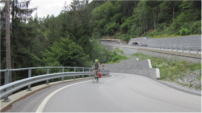
Riding the switchbacks on the Rhine Route. Switzerland has many hills be we didn't find anything that would stop our passage. Roads where is good shape and there was not much vehicle traffic. Trains can be used to get over difficult parts.
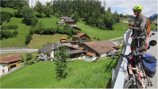
Checking the route at the top of the switchbacks in the previous photo.