Germany, The Moselle and Rhine
Moselle: part of the international cycle route Velo Tour Moselle, starts in the small town of Perl and ends in Koblenz at the Rhine. Riders can expect 300 kilometers of varied landscape on predominantly flat terrain. From Perl, the route leads through the middle of the cultivation area of the 2,000-year-old Elblingrebe, a wine specialty of the Moselle region. The route is gentle, well signed and easy to follow.
Rhine: Part of EuroVelo 15, this 1,200 km course is characterized by large historical buildings such as castles, fortresses, churches and historic towns. Dome to Speyer, Worms, Mainz and Cologne showcase the prosperity of the cities; bastions such as the fortress Ehrenbreitstein in Koblenz and the Breisacher Münsterberg highlight the strategic importance of this route. Many of the sites along the Rhine Cycle Route are UNESCO World Heritage sites.
From the source of the Rhine in the Alps to the mouth in the North Sea, the route encompasses mountains to lowlands, through various landforms, overall the route is flat. Only in the alpine areas are there step and difficult sections. The route mainly asphalted, mostly car-free, and in the central Rhine often next to trains and roads.
Guides, Maps and Other Information
Moselle River ADFC site with a description of the route and useful links.
Moselle Region Cycle Paths Moselle region official tourist site with detailed information about cycle paths in the region.
![]() Moselle Cycle Path Rhienland Pflaz cycling site with detailed cycling instructions for the Moselle.
Moselle Cycle Path Rhienland Pflaz cycling site with detailed cycling instructions for the Moselle.
Moselle Cycle Route. Verlag Esterbauer has a map book for the Moselle, although the route is easy to follow without detailed maps, just stay in the river valley. The guide can be found under "Bikeline Radtourenbücher"
Rhine River ADFC site with a description of the route and useful links.
EuroVelo 15 on the Rhine River EuroVelo 15 Site.
Rhine Part 1. Verlag Esterbauer has a good map series for the Rhine. This is a link to part 1 starting in the Swiss Alps. Rhine guides can be found under "Bikeline Radtourenbücher"
![]() Cicerone Cycling. has guide books for the Moselle and Rhine. Click the "more books" link on the page.
Cicerone Cycling. has guide books for the Moselle and Rhine. Click the "more books" link on the page.
See the Maps and Guides page for more mapping information.
Information and a map of the Moselle cycleway can be found here on Mosel WeinKulturLand.
An interactive map of the Rhine cycleway route can be found here on Rheinradweg.
Map information
There are many cycling apps with maps available for iphone and android. A couple of the better offline apps are listed here.
![]() Can be used to follow this route (and other routes) Click here for KML files that can be loaded into the app. Rhine Cycleway Mosselle Cycleway Place the file in the maps.me bookmarks folder (MapsWithMe/bookmarks on your phone or tablet) or alternately, email/text it to your device and open the file with maps.me. Total Commander works great for managing and opening files.
Can be used to follow this route (and other routes) Click here for KML files that can be loaded into the app. Rhine Cycleway Mosselle Cycleway Place the file in the maps.me bookmarks folder (MapsWithMe/bookmarks on your phone or tablet) or alternately, email/text it to your device and open the file with maps.me. Total Commander works great for managing and opening files.
![]() Guru Maps has the ability to show map types other than OpenStreetMap, in particular it will display OpenCycleMap. KML files can be imported by "opening" the file with Guru. To import the KML file place the file in a folder or email it to your device, press and hold and open with the app. The route will appear in "collections." A good user manual is available for the app.
Guru Maps has the ability to show map types other than OpenStreetMap, in particular it will display OpenCycleMap. KML files can be imported by "opening" the file with Guru. To import the KML file place the file in a folder or email it to your device, press and hold and open with the app. The route will appear in "collections." A good user manual is available for the app.
What it is Like
They Moselle river is a quick ride by long distance cycling standards and the Rhine is very long taking the rider through the heart of Europe. One could ride the Moselle to Koblenz and then follow the Rhine either up stream or downstream to other routes if you have the time. The upper Rhine is a great place for cyclist and includes the Die Bodensee (Lake Constance) which is itself a cycling destination. Die Bodnesee is easily circumnavigated by bicycle.
Following the Rhine downstream takes the rider to some of the busiest industrial areas in Europe but don't be discouraged. The riding is good and you can connect to other cycleways in the Netherland or Belgium.
- Best Season
This area is northwest Europe and so can be rainy and cold in spring and fall. Summers will have the best weather but August is tourist season so hotels can be full in some areas.
Moselle Cycleway
- Elevation Changes
The cycleway follows the Moselle through mostly rolling hills and vineyards. The valley of the Moselle is steep to ride out of but the cycleway itself is level and gently follows the river. It is suitable for children, cycle trailers and tandem bikes, though restrictions apply in some sections.
- Ride Quality
Asphalt is the main surface with a few gravel paths suitable for the cyclist. The cycleway is a combination of dedicated bike paths and quite roads, and only rarely are sections directly on busy roads. There are very few difficult sections. The section between Bullay and Senheim and between Cochem and Treis-Karden has some graveled path. If there is too much traffic on a portion of the ride, you can always change locations using one of the numerous bridges and ferries to the other bank of the Moselle.
- Distance: 278 kilometers.

The Moselle Valley is steeply sided with vineyards along both banks of the river. Small towns with services are frequent.

Camping is sometimes available along the Moselle.

The Moselle is the place to be if you like reisling wines.
Rhine Cycleway
Along one of the longest rivers in Europe, the Rhine cycleway (EuroVelo 15) is suitable for cyclists of all fitness levels and abilities. Along its nearly 1,300 kilometer length, the EV15 crosses four countries - Switzerland, France, Germany and the Netherlands. Its source is at Andermatt in the Swiss Alps and its mouth is near the great port of Rotterdam in the Netherlands. The route is extensively described in on other sites so just a few photos are shown here.
- Elevation Changes
From the source of the Rhine in the Alps to the mouth in the North Sea, the route covers widely varying terrain from mountains to lowlands, through various landforms, overall the route is flat. Only in the alpine areas are there step and difficult sections. The route is mostly asphalted, mostly car-free, and along the central Rhine often next to trains and roads.
- Ride Quality
Asphalt is the main surface with a few gravel paths suitable for the cyclist. The cycleway is a combination of dedicated bike paths and quite roads. In Switzerland, the route usually runs on quiet country roads, they may be unpaved but are easily navigated forest roads or bike paths. In alpine areas there may be problems with snow in the spring.
In Germany the route is mostly on cycle paths near the river, in the Netherlands the route is on quiet rural roads and farm roads through forests and fields as well as along smaller rivers and canals. Even though the route is through densely populated areas, only a few sections are in heavy traffic near Dusseldorf.
- Distance: 1233 kilometers.
- Travel Tips
Ride or take the train to St. Gallen if you are in the Bodensee area. Must sees are the Cathedral, Library and Textile Museum. If you are tired take the train to Andermatt and ride downstream.

On a country road near Worms. Some riding on small agricultural roads is possible.
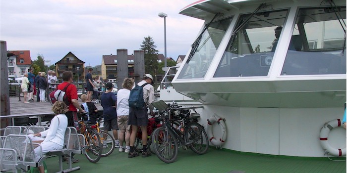
You don't have to cycle the entire distance. Take your bike on one of the many tour boats along the Rhine.