Canal du Midi and Canal de Garonne
Stretching from Bordeaux to Toulouse, the Canal des Deux Mers – the Canals of the Two Seas – links the Atlantic to the Mediterranean. The route is made up of the Canal de Garonne and the Canal du Midi. Travel this route from West to East and you will be going with the prevailing winds.
The route between Bordeaux and Sete includes three waterways, starting with a 53km section of the Garonne River from Bordeaux to Castets-en-Dorthe. Onwards the route follows the Canal de Garonne for 193km before arriving in Toulouse. From here, Sète is a 240km bike ride along the Canal du Midi.
Along the Canal de Garonne the path is paved and in good condition. The route from Bordeaux follows the Roger Lapebie bike path, followed by a section which links to the start of the Canal de Garonne proper. From here it's an excellent 193km ride to Toulouse.
The Canal du Midi is a 240km section from Toulouse in the Haute Garonne to Sète on the Mediterranean Coast . This is a level and senic route with many historic towns and villages along the way. The path is a mix of paved and unpaved track but is easily done on a touring bike. The route includes sights close to the canal and towns farther along such as Carcassone, Narbonne, Minerve, and Béziers.
Guides, Maps and Other Information
This route is extensively documented, you will find lots of information on the Internet. Here are some of the more helpful sites:
Canal des Deux Mers à Vélo Easy to use map. "You can pedal along for almost 800km beside the Canal de Garonne and the Canal du Midi, the latter a World Heritage Site, to explore unforgettable landscapes and sites.""
Freewheeling France "Everything you need to know about cycling in France." Lots of detail and links to useful information.
![]()
French Waterways Provides some interesting history and a description of the lock system, a highlight of the ride.
Cicerone's guide to the Canal du Midi "Across Southern France from Toulouse to Sète."
The Canal du Midi and the Green Road A site for ordering useful hardcopy maps.
Experience France A site similar to this but dedicated to cycling in France. Try the page "Cycling Across France: 10 Favorite Places".
See the Maps and Guides page for more mapping information.
![]()
Canal des Deux Mers à Vélo This is the best outline of the route.
There are many cycling apps with maps available for iphone/ android. Here are a couple of the better offline apps.
![]() Can be used to follow this and other routes. It is based on OpenStreetMap and covers most of the planet. It does not display OpenCycleMap. Click here for a KML file that can be loaded into the app. Canal du Midi Cycleway. Place the file in the maps.me bookmarks folder (MapsWithMe/bookmarks or alternately, email/text it to your device and open the file with maps.me. Total Commander works great for managing and opening files.
Can be used to follow this and other routes. It is based on OpenStreetMap and covers most of the planet. It does not display OpenCycleMap. Click here for a KML file that can be loaded into the app. Canal du Midi Cycleway. Place the file in the maps.me bookmarks folder (MapsWithMe/bookmarks or alternately, email/text it to your device and open the file with maps.me. Total Commander works great for managing and opening files.
![]() Guru Maps has the ability to show map types other than OpenStreetMap, in particular it will display OpenCycleMap.
Guru Maps has the ability to show map types other than OpenStreetMap, in particular it will display OpenCycleMap.
What it is Like
Canal du Midi and Canal de Garonne is one of the easiest rides in France, simple to navigate and very level since the route follows canal tow paths. Its not a loop ride though, you might want to travel to and from different aiports or take a train back to the starting point. Most of this route is paved or on packed gravel. The entire route is easily done with a hybrid bike.
- Travel Tips
Go with the prevailing winds, ride this route from West to East. Winds can be strong in the spring and fall and you will have a much better ride with the wind at your back.
- Ride Quality
At least 90 percent or more of the cycleway is paved and a large percent is dedicated bike paths directly along the canals. The few sections that are on packed gravel are easily done on a touring bike. This is one of the easiest rides in Europe, is suitable for family travel and is very level.
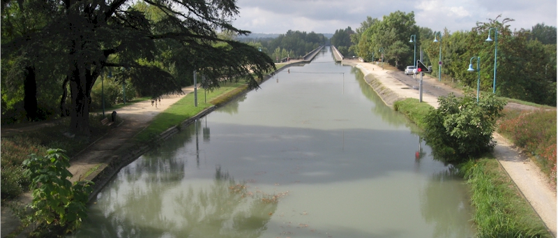
View of the cycleway not far from Bordeaux.
- Elevation Change
A almostly entirely level ride, following the canals across France. It is a gradual climb to Toulouse and then a gradual downhill ride to the Mediterranean
- Best Season
Spring and Fall. Summer is way too hot and winter is cold and wet.
There are many historical villages and sites along this route, each worth a visit. Outdoor markets can be found in many of the cities and villages. Get your lunch in the market and take it to a scenic location on the canal.
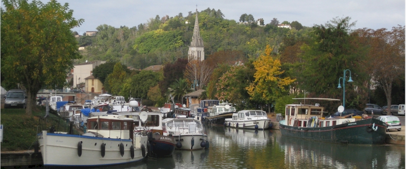
Many boaters use the canals, particularly in winter months as a refuge from storms on the Mediterranean. A good source of information about the route and condition of the locks and canal can be found in the French Waterways guides.
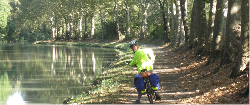
Most of the route is bordered with large sycamore trees that create a colorful ride in the fall.

You will not be alone on this route. The canal paths are used for local transportation as well as long distance cyclist.